
Tanyard Creek Nature Trail- Bella Vista, Ark. Credit Source: www.beautifulbellavista.com
Hiking is an activity that allows people to explore their surroundings and lose themselves in nature. This is a very popular form of outdoor recreational activity for many Americans. Southwest Missouri and its surrounding areas have many extravagant trials to elegant waterfalls waiting to be explored. According to the website Statista, “In 2012, there were approximately 34.55 million participants in hiking in the United States.” Below is a list of hiking locations in the area.
Gibson Spring-Neosho, MO (Easy)
Length: 0.66 mile Approx. time of hiking: 0.5
Description: Wildlife is present on trial. This is a short walk through the oak hard-woods of the Ozarks. Picnic tables are around the spring. This is a conversation area so no ATV’s are allowed, and horses may only be in designated areas.
George Washington Carver National Monument Trail-Diamond, MO (Easy)
Length: 1.1 miles Approx. time of hiking: 0.3 hour
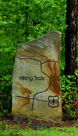
Description: This trail features asphalt pavement and a disability accessible section for the first ¼ mile. This is a historic one mile loop trail that features a creek and pioneer cemetery. It also passes through a restored prairie. There are multiple signs along the way to help direct hikers.
Wildcat Glades Walk- Joplin, MO (Easy)
Length: 0.54 miles Approx. time of hike: 0.5 hour
Description: The Wildcat Glade Walk features local fishing and camping areas. This trail was made for the unique lichens and lichen grasshoppers that are in this park. The Chert glade and creek provide interesting views during the walk.
Chinquapin Trail- Pineville, MO (Moderate)
Length: 3.1 miles Approx. time of hike: 2 hours
Description: Chinquapin Trail is a 3.1 mile loop trail located near Pineville, Missouri that features a river and is rated as moderate. The trail is primarily used for hiking & nature trips. The trail is dog friendly.
Credit source: Explore the Ozarks
Tanyard Loop- Bella Vista, AR (Easy)
Length: 2.1 miles Approx. time of hike: 1.5 hour
Description: Tanyard Creek Nature Trail is approximately 2 miles long and located near Bella Vista, Arkansas. It features a waterfall and many identifying markers. The trail is good for all skill levels and primarily used for nature trips & walking. Dogs are also able to use this trail but must be kept on leash.
Huckleberry Ridge State Forest-Pineville, MO (Hard)
Length: 14 miles Approx. time of hike: 3 hours
Description: Huckleberry Ridge State Forest is a 14 mile loop trail located near Pineville, Missouri. The trail is primarily used for horseback riding. Also appears to be good for mountain biking and hiking.
Blowing Springs Trail System- Bella, Ark. (Moderate)
Length: 7 miles Approx. time of hike: 2.5 hours
Description: This trail is great throughout the year. It features caves, waterfalls and abundant wildlife. This trail has a 394 feet gain throughout the trail loop.
Eagle’s Nest Trail-Cassville, Mo (Moderate)
Length: 2.3 miles Approx. time of hike: 1.5-2.5 hours
Description: The first part of the trail will give you a great sight of the river. It will lead you to one of the highest points in the Roaring River State Park. Nature is very abundant through this 2.3 mile hike.
For more information visit:
www.exploretheozarksonline.com

Leave a Reply